createIntermediateRasters
Introduction
This utility uses two input DEMs (i.e. raster files of digital elevation models) located at the exact same spatial position but at different elevation and calculates a specified number of raster DEMs located at equidistant distance between them (i.e. for n=1, one new raster located precisely in the middle will be created).
Usage
   createIntermediateRasters --file1 <file1.asc> --file2 <file2.asc>
                             -o <output.asc> [-n <int>]

Where:

   --file1 <file1.asc>
     (required)  First DEM-raster file

   --file2 <file2.asc>
     (required)  Second DEM-raster file

   -o <output.asc>,  --output-file <output.asc>
     (required)  Raster output file (*.asc)

   -n <int>,  --number <int>
number of rasters to be calculatedThe parameter n determines how many layers are created between the two input layers. If the parameter is not specified the default value is set as n=1.
Simple example
Input data:
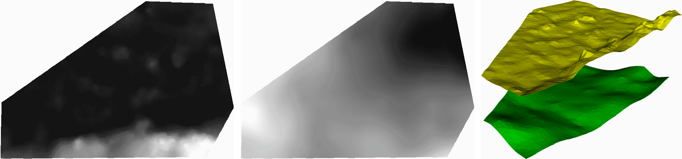
Command:
createIntermediateRasters --file1 raster1.asc --file2 raster2.asc -o output.asc -n 1
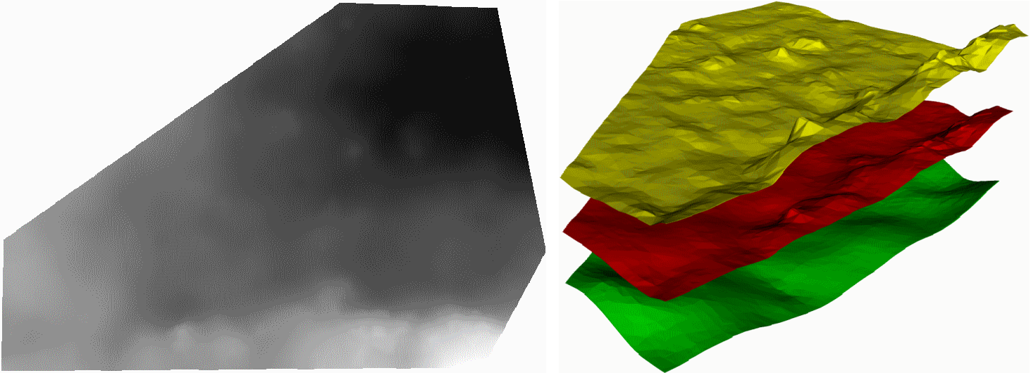
Command:
createIntermediateRasters --file1 raster1.asc --file2 raster2.asc -o output.asc -n 2
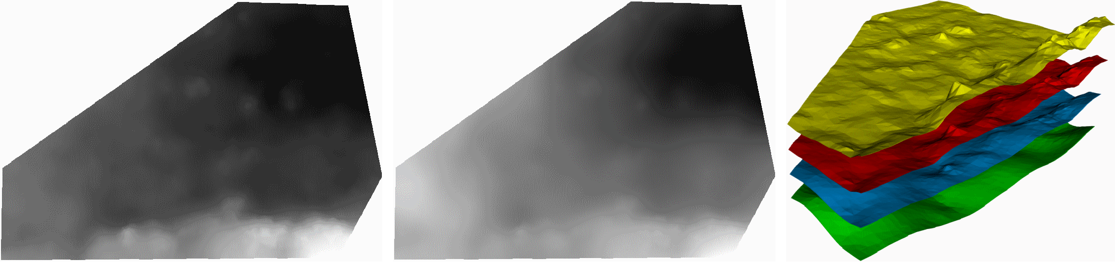
n>1 multiple rasters are created at equidistant distances between the two input rasters. For n=2, two new rasters are generated, represented here in red and blue.
Application
This utility allows to generate additional input data when creating a bulk mesh from geometry and raster layers. The existing layer structure given via raster files can be refined to avoid deformed elements if the resolution in x-/y-direction is significantly more detailed than in z-direction.
This article was written by Karsten Rink. If you are missing something or you find an error please let us know.
Generated with Hugo 0.147.9
in CI job 577984
|
Last revision: May 22, 2025
Commit: Remove deprecated TES process 6477209a
| Edit this page on