Map geometric object to the surface of a mesh
General
The tool MapGeometryToMeshSurface adjusts the z-coordinates of geometric points from a given geometry file my_geometry.gml such that they are located on the surface of a given mesh my_mesh.vtu and returns an updated geometry file my_mapped_geometry.gml.
Usage
MapGeometryToMeshSurface -m [my_mesh.vtu] -i [my_geometry.gml] -o [my_mapped_geometry.gml]Simple application example
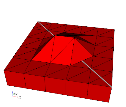
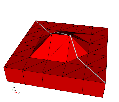
Usage for the example:
MapGeometryToMeshSurface -m SubsurfaceMesh.vtu -i TestPolyline.gml -o TestMappedPolyline.gmlReferences
Karsten Rink, Lars Bilke, Olaf Kolditz: Visualisation Strategies for Environmental Modelling Data. Environmental Earth Sciences, 2014. DOI:10.1007/s12665-013-2970-2 download
Example Files
This article was written by Thomas Fischer. If you are missing something or you find an error please reach out
to us on our forum.
Generated with Hugo 0.164.0
in CI job 825193
|
Last revision: April 20, 2026
Commit: refactor(MeshLib): remove PropertyVector::push_back 870422dde
| Edit this page on